Géosciences marines
GEOSCIENCES : Sedimentology, Géohazards, Coastal dynamics
Population growth in coastal areas increases their vulnerability to marine and geological hazards, exacerbated by climate change. 110 projects supported by the ANR have led to major advances in different sectors: modeling of sediment dynamics, monitoring of underwater risks (earthquakes, tsunamis), and assessment of coastal vulnerability. By combining physical, socio-economic data, and innovative tools (AI, sensors, satellite imagery), this research strengthens the alert and adaptation capacity of coastal territories, laying the foundations for more resilient management in the face of climatic and geological pressures.
Gilles Lericolais : Ifremer/SG Mer, Bruno Castelle : Univ Bordeaux
1) Scientific background:
The Earth’s population has reached 8.2 billion people in 2024, of whom more than 2 billion live near the coast and could reach 2.9 billion by 2050 according to the United Nations population estimates and projections report, 2024. This high population density along the coasts and the expected growth of complex critical infrastructure and ocean services in coastal regions lead to increasing levels of exposure and vulnerability to marine geohazards. Indeed, these coastal areas are subject to risks that can lead to severe impacts due to the high concentration of people and assets in exposed locations. In particular, climate-induced sea-level rise will exacerbate these risks during the 21st century.
A geohazard is a geological condition that represents – or has the potential to develop – a situation leading to uncontrolled damage or risk. The United Nations Office for Disaster Risk Reduction (UNDRR) defines intensive risk as disaster risk associated with low-probability, high-impact events, while extensive risk is disaster risk associated with high-probability, low-impact events. Dangerous marine geological events can occur at any time and the scientific community, the maritime industry and government agencies are called upon to cooperate to better understand and monitor the processes involved in order to mitigate the unpredictable damage that results.
The marine geoscience projects funded by ANR, whether for the understanding of sedimentary processes (sedimentary hydrodynamics) or on the understanding of geological risks, have increased knowledge on marine geohazards and therefore shed light on the measures needed to reduce our exposure and vulnerability to such events. This corresponds to one of the societal objectives of the United Nations Decade of Ocean Science for Sustainable Development (2021-2030), which advocates a safe ocean where lives and livelihoods are protected from ocean-related hazards.
Coastal regions are facing increasing risks from natural hazards such as coastal erosion, flooding, and submersion, which are being intensified by climate change. Rising sea levels, along with changes in storm frequency and intensity, pose serious threats to coastal communities, infrastructure, and ecosystems. Understanding, modelling, and predicting coastal evolution is therefore essential to developing effective adaptation strategies and mitigating future risks. Coastal change is, however, a complex problem driven by multiple nonlinear processes interacting with each other on a wide range of time and space scales. At small scales, waves, tides, and currents move the sediment through different modes and reshape the seabed. At larger scales, extreme events, sea-level fluctuations, and human interventions influence coastal evolution over days, decades to centuries. Because these nonlinear processes and feedback mechanisms, predicting future changes remains a major scientific challenge. Progress requires combining small-scale physical process studies, through laboratory experiments, upscaling and process-based modelling, with large-scale approaches such as reduced-complexity models and satellite remote sensing to track long-term shoreline change an large spatial scales. The accuracy of the models and remote sensing algorithms also heavily rely on high-quality, detailed, ground-truth data through intensive field measurements and long-term monitoring program.
Over the past 20 years, major scientific advances through ANR-funded projects have improved our understanding of sediment transport, feedback mechanisms, and the impacts of extreme events. Such processes can now be transformed into parametrisation into larger-scale models, which have been used in other ANR-funded projects to explore future changes, including under the effects of climate change. Satellite remote sensing also transformed the, large-scale multi-decadal, coastal science from a data poor to a data rich field, recently making possible data assimilation, application of machine and deep learning techniques and shoreline change assessments at global scale. Although limitations and knowledge gaps remain, these developments have led to better long-term projections and uncertainty assessments, providing valuable tools for engineers, policymakers, and coastal managers.
2) Main Contributions of the French Communities through ANR co-funding.
2-1 Scientific progress; cutting edge science
Today, the expansion of economic activities is driven by a combination of population growth, rising incomes, diminishing natural resources, responses to climate change and pioneering technologies. The “blue economy” thus encompasses established ocean industries as well as emerging and developing activities that are reshaping and diversifying maritime industries (OECD, 2016). These activities include offshore renewable energy, communications, maritime cruise tourism, offshore aquaculture, marine biotechnology and bioprospecting, seabed mining, aggregate extraction, ocean monitoring, control and maritime surveillance. Other activities for which there are not yet established markets include carbon sequestration, coastal protection, waste disposal and biodiversity conservation and restoration.
ANR participates in the European Partnership for a Sustainable Blue Economy. The objective of this Partnership is to accelerate the transformation towards a climate-neutral, sustainable, productive and competitive blue economy. This is to restore the health, resilience and services provided to ocean populations by promoting climate-neutral, sustainable and productive economic activity. Such objectives cannot reach without encompassing geohazards.
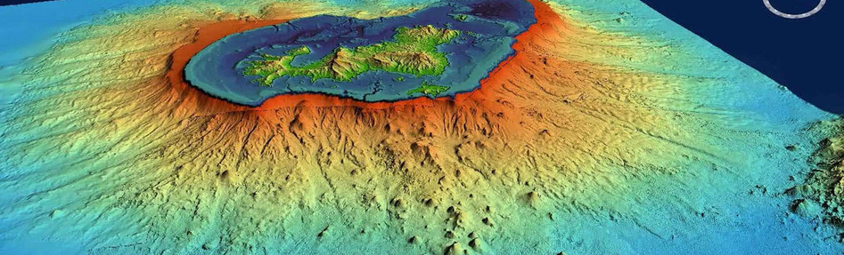
Marine geohazards related to seabed processes include earthquakes (the most destructive earthquakes to affect humanity have occurred at sea), landslides, volcanic eruptions and associated tsunamis. Marine geohazards can also include rapid changes on the seabed such as the migration of submarine dunes (bedforms), seabed liquefaction and gas migration that can lead to local overpressure in sediments and potential submarine landslides. To date, most geohazards occurring on the seabed are unknown, poorly characterized and difficult to monitor (with current technology).
Hazards are intimately linked to risk. A risk is the probability that an event resulting in loss of life, injury, or destruction or damage to property could occur to a system, society, or community within a given time frame. A risk is therefore determined as the product of three factors: hazard, i.e. the probability that a given event will occur within a given time; exposure, i.e. the human lives and the quantity and value of property exposed to the hazardous event; and vulnerability, i.e. the amount of damage the event will cause to the exposed property. The main marine geological hazards are coastal erosion, seawater intrusion, earthquakes, submarine landslides, subsidence, tsunamis, dissociation of natural gas hydrates, seabed sand waves, shallow gas, overpressure strata, gas chimneys, mud volcanoes, and mud diapirism.
The advancement of deep-sea exploration activities, uncertainties about the consequences of climate change, recent global catastrophic events (e.g. the 2004 Indian Ocean and 2011 Japanese tsunamis) correlated with the increase in human population density in coastal regions of the world are responsible for the increased importance and awareness related to marine geohazard research. Specific threats to society related to marine geohazards are the loss of land near the coast, the devastation of coastal areas by tidal waves generated by landslides and the destruction of marine facilities, (e.g. communication cables, pipelines).
ANR funded projects collectively bridge gaps between fundamental processes and practical applications, from small-scale sediment transport in turbulent flows to large-scale coastal evolution under varying climatic scenarios. A major scientific breakthrough in sediment transport has come from projects like SHEET-FLOW, WEST, 2-phaseSEDEXPn, and RUPTURE, which have refined our understanding of sediment dynamics under high-energy conditions. These projects focused on the complex fluid-particle and particle-particle interactions that occur during sediment transport, particularly under energetic flows and during extreme events like storms and hurricanes. SHEET-FLOW, for example, has advanced two-phase sediment transport models, incorporating acoustic instrumentation to measure velocity and sediment concentration at turbulent scales, revealing the key role of sheet flows in sediment dynamics. Similarly, WEST has provided new insight into sediment transport during recovery phases, focusing on accretion and bed slope adjustments after storms, with has implications for coastal resilience. The 2-phaseSEDEXPn and RUPTURE projects further refine our understanding of turbulence-induced sediment transport, using new ultrasound and hydro-acoustic techniques to measure sediment fluxes in turbulent flows. These advancements have significantly improved sediment transport models, allowing for more accurate predictions of bedform evolution and coastal erosion.
Beyond sediment transport, several projects have focused on the long-term evolution of coastlines, particularly in response to climate change and storm events. Projects like VULSACO and SHORMOSAT offer a broader understanding of coastal systems and their vulnerability to climate change. VULSACO, for instance, has developed vulnerability models for sandy coastal areas, assessing both short-term storm impacts and long-term erosion trends under future climate scenarios. The integration of socio-economic factors into these models has provided a more holistic view of coastal vulnerability. COASTVAR, focusing on tropical coastlines in West Africa and Vietnam, has employed innovative observational tools like drones and video imagery, as well as 3D coupled models, to study wave-induced circulation and surf-shelf exchanges. This research has significantly advanced our understanding of the hydrodynamics and sedimentary processes in these regions, which had received little attention by the scientific community so far. SONO has tackled the key role of beach-dune systems in coastal resilience. By studying dune evolution in response to human management and climate change, SONO has integrated geomorphological, ecological, and hydrodynamic data to develop a new coastal dune modelling framework. This research was used to improve coastal management practices in southwest France and beyond, especially in areas where dunes serve as vital buffers against storm surges and erosion. SHORMOSAT has made breakthrough advancements in large-scale shoreline change modelling by integrating satellite-derived data and improving shoreline models. This project has focused on understanding how shoreline changes are influenced by factors such as sea-level rise, wave conditions, coastal structures, and by addressing projections uncertainties.
Together, these projects highlight a significant advancement in our understanding of coastal dynamics, emphasizing the interactions between natural processes and human influences. They have not only expanded the fundamental scientific knowledge of coastal systems but have also provided practical tools for coastal zone management and planning. For example, the integration of numerical models with satellite observations in SHORMOSAT and GLOBCOASTS offers unprecedented opportunities for global coastal monitoring, while the development and/or improvement of process-based models in COASTVAR, CHIPO or KUN-SHEN helps anticipate future changes in coastal systems under various climatic conditions. Overall, these projects contribute to a more integrated understanding of coastal systems, particularly in the context of climate change
2-2 Innovation for private enterprises, for science policy, for the citizen with a focus of coastal communities
The ANR projects' results address Challenge 6 (Improve multi-hazard early warning services for all ocean and coastal hazards of geophysical, ecological, biological, meteorological, climatic and anthropogenic origins, and integrate community preparedness and resilience) of the UN Decade of Ocean Science for Sustainable Development (2021-2030). This is realised by presenting how to increase public authorities’ awareness of marine geohazards and frame marine geohazards in administrative management rules.
For a safe and sustainable use of the seabed, public authorities and policy makers responsible for coastal and maritime management and planning must be aware of the importance of marine geohazards. National and local government agencies responsible for coastal communities and infrastructure are well aware of land-based natural hazards, but the potential of offshore threats remains largely unknown. The reasons for this lack of attention are: 1) technologies to highlight marine geohazards are relatively new; and 2) until a decade ago, the use of the seabed was limited and there was little need to manage submerged territories. Similarly, public awareness of natural marine hazards is often low, even though the two very large tsunamis that hit Asia in 2004 (Indonesia) and 2011 (Japan) demonstrated how real marine geohazards can be and that they are not “a thing of the past”. It is therefore necessary that marine geohazards be included as natural hazards in all policies related to risk mitigation and land management.
By blending fundamental research on coastal dynamics with practical tools for coastal management and forecasting, ANR-funded projects provide a comprehensive approach to addressing the challenges faced by coastal communities worldwide. With rising concerns over climate change, coastal areas, particularly sandy beaches, are highly vulnerable to erosion, submersion, and extreme weather events. Projects like VULSACO, SHORMOSAT and COASTVAR have advanced the understanding of how human activities, such as urbanization and tourism, exacerbate these vulnerabilities. By integrating socio-economic factors into physical models, these projects are helping coastal managers anticipate the impacts of future storms and sea-level rise, informing adaptation strategies that are both scientifically sound and socially relevant. The integration of public and private stakeholders has also fostered collaborative solutions for beach restoration, and for instance coastal dune management in SONO contributing to more resilient coastal ecosystems. Furthermore, the development and application of advanced monitoring systems like drones, UAV surveys, and satellite imagery, as seen in GLOBCOASTS and SHORMOSAT, can now provide unprecedented data for making informed decisions.
Methodological breakthrough
The lack of an appropriate policy framework to guide the management of marine geohazards is a specific obstacle to the management of these risks. Due to the novelty of tools for detecting and quantifying marine geohazards, national and international legislation is often poorly defined. Local land management agencies should be required to translate scientific knowledge on marine geohazards into regulatory guidelines or restrictions to be applied, and to co-develop with civil protection agencies (or other similar bodies) emergency measures.
There is a need to integrate marine monitoring infrastructures such as the European Multidisciplinary Seabed and Water Column Observatory (EMSO) and all other long-term monitoring of high-risk areas with seabed mapping and geohazard research.
Permanent seafloor observatories continuously collect environmental data at a fixed location, while mapping seafloor geohazard characteristics will provide spatially continuous but time-accurate data. Since seismic, acoustic and chemical signals from the seafloor can travel tens of kilometres, a comparison between detailed geohazard characteristic maps and observatory signals will allow us to understand the evolution of geohazard phenomena such as mass loss, volcanic eruptions, fault activity and gravitational flows over time, and potentially to define precursors.
New technologies should facilitate long-term in situ monitoring combined with geohazard studies in surrounding regions to identify long-range signals. Dedicated marine geohazard field laboratories should be established at targeted sites to concentrate research, facilities and in situ modelling.
The projects have also introduced methodological breakthroughs that enhance our ability to predict, model, and manage coastal dynamics. CHIPO, for instance, has innovated by combining longshore and cross-shore processes into unified models, filling a gap in the study of beach morphodynamics. By initiating the development of a new generation of reduced-complexity shoreline models, complementary to traditional process-based models, CHIPO reduced simulation errors while providing cost-effective solutions for long-term shoreline predictions. Similarly, SHEET-FLOW and RUPTURE have made advancements in sediment transport modelling by resolving two-phase flow interactions, which are essential for accurately simulating sediment fluxes during turbulent conditions. The use of cutting-edge hydro-acoustic techniques and advanced sediment transport models in RUPTURE represents a significant leap in understanding fine-scale sediment transport dynamics. Additionally, the innovative data assimilation techniques developed in SHORMOSAT and GLOBCOASTS are setting new standards for global coastal monitoring, enabling more precise predictions of shoreline change and coastal evolution. These methodological advancements not only allowed enhanced scientific knowledge, but also provide practical tools and data for the scientist community as well as coastal managers.
3) Research perspectives.
The perspectives to be considered today for moving towards a more in-depth assessment of marine risks involve scientific research on marine geohazards, which is essential for understanding the characteristics, magnitude and recurrence intervals of events (i.e. how often they occur in the same place). For example, the magnitude of an earthquake that a fault can generate depends on its geometric characteristics and its relationship with deeply rooted active geological structures; the tsunamigenic potential of a volcano depends on the explosiveness of its past eruption(s) and the stability of its flanks. Sedimentary movements linked to ocean currents or sea-level rise generate risks on marine or coastal infrastructures. The magnitude of the geohazard is very different if an area is subject to storms or landslides every year, once every ten years, once a century or once a millennium. Scientific studies on marine geohazards therefore focus on: 1) the identification of past geohazard events and the assessment of their frequency, as well as 2) the monitoring of current active processes that may evolve into a marine geohazard.
Recently, the development of mathematical models for hazard definition, geotechnical measurements, field and laboratory data collection, and event dating has gradually increased. These tools can be applied to understand the formation and mechanisms of marine geohazards and their consequences, but also to develop warning systems before these disasters.
A challenge for future coastal research is improving the integration of multiple data sources and models to enhance predictions and better understand coastal change. Combining satellite observations with machine learning and deep learning algorithms represents a promising direction for refining our ability to forecast future coastal changes on a wide range of time and space scales. Such integration could improve understanding of coastal dynamics over large spatial scales, accounting for both natural variability and human influence, and offer more reliable projections of coastal evolution. Another issue in advancing coastal research is the quantification of uncertainties in model outputs. While progress has been made in the frame of recent ANR-funded projects, there remains a need to better understand the sources of uncertainty and how these propagate through the models. Future research should focus on improving uncertainty quantification methods, particularly in relation to the effects of climate change and human activities, to tackle where uncertainties can be reduced, and to generate more accurate predictions. The integration of human influences, such as coastal structures, beach nourishment, and land use, as well as biotic-abiotic interactions in certain environments, remains underexplored. Another important avenue for future research is the development of innovative, cost-effective monitoring and modelling tool, to enhance real-time monitoring of coastal systems, allowing for rapid response to extreme events and improving long-term coastal planning
Brown S, Nicholls RJ, Woodroffe CD, Hanson S, Hinkel J, Kebede AS, Neumann B and Vafeidis AT (2013) Sea-level rise impacts and responses: A global perspective. In Finkl CW (ed.), Coastal Hazards, Coastal Research Library. Dordrecht: Springer SV, pp. 117–149. Chiocci, F. L., Cattaneo, A., & Urgeles, R. (2011). Seafloor mapping for geohazard assessment: state of the art. Marine Geophysical Research, 32(1–2), 1–11. https://doi.org/10.1007/s11001-011-9139-8 Dan, G., Sultan, N., & Sayove, B. (2007). The 1979 Nice harbour catastrophe revisited: Trigger mechanism inferred from geotechnical measurements and numerical modelling. Marine Geology, 245(1–4), 40–64. https://doi.org/10.1016/j.margeo.2007.06.011 Jousset, P., Reinsch, T., Ryberg, T., Blanck, H., Clarke, A., Aghayev, R., Hersir, G. P., Henninges, J., Weber, M., & Krawczyk, C. M. (2018). Dynamic strain determination using fibre-optic cables allows imaging of seismological and structural features. Nature Communications, 9. https://doi.org/10.1038/s41467-018-04860-y Kopp, H., Chiocci, F. L., Berndt, C., Çağatay, M. N., Ferreira, T., Fortes, C. J. E. M., Gràcia, E., González Vega, A., Kopf, A. J., Sørensen, M. B., Sultan, N., Yeo, I. A. (2021) Marine geohazards: Safeguarding society and the Blue Economy from a hidden threat. Muñiz Piniella, A., Kellett, P., van den Brand, R., Alexander, B., Rodríguez Perez, A., Van Elslander, J., Heymans, J. J., [Eds.] Position Paper 26 of the European Marine Board, Ostend, Belgium. 100 pages. ISSN: 2593-5232. ISBN: 9789464206111 DOI: 10.5281/zenodo.5591938. OECD. (2016). The Ocean Economy in 2030. OECD Publishing. https://doi.org/10.1787/9789264251724-en Oppenheimer M, Glavovic BC, Hinkel J, van de Wal R, Magnan AK, Abd- Elgawad A, Cai R, Cifuentes-JaraM, DeConto RM, Ghosh T, Hay J, Isla F, Marzeion B, Meyssignac B and Sebesvari Z (2022) Sea level rise and implications for low-lying Islands, coasts and communities. In Pörtner H-O, Roberts D-C, Masson-Delmotte V, Zhai P, Tignor M, Poloczanska E, Mintenbeck K, Alegría A, Nicolai M, Okem A, Petzold J, Rama B and Weyer NM (eds.), The Ocean and Cryosphere in a Changing Climate. Cambridge: Cambridge University Press, pp. 321–446. Sultan, N., Garziglia, S., Bompais, X., Woerther, P., Witt, C., Kopf, A. J., & Migeon, S. (2020). Transient Groundwater Flow Through a Coastal Confined Aquifer and Its Impact on Nearshore Submarine Slope Instability. JGR Earth Surface, 125(9). https://doi.org/10.1029/2020JF005654 Sultan, N., Savoye, B., Jouet, G., Leynaud, D., Cochonat, P., Henry, P., Stegmann, S., & Kopf, A. J. (2010). Investigation of a possible submarine landslide at the Var delta front (Nice continental slope, southeast France). Canadian Geotechnical Journal, 47(4). https://doi.org/10.1139/T09-105 United Nations, Department of Economic and Social Affairs, Population Division (2024). World Population Prospects 2024: Methodology of the United Nations population estimates and projections. UN DESA/POP/2024/DC/NO. 10, July 2024. Zscheischler J, Martius O, Westra S, Bevacqua E, Raymond C, Horton RM, van den Hurk B, AghaKouchak A, Jézéquel A, Mahecha MD, Maraun D, Ramos AM, Ridder NN, Thiery W and Vignotto E (2020) A typology of compound weather and climate events. Nature Reviews Earth&Environment 1, 333–347.Bibliography
Reimann, Lena & Vafeidis, Athanasios & Honsel, Lars. (2023). Population development as a driver of coastal risk: Current trends and future pathways. Cambridge Prisms: Coastal Futures. 1. 1-23. 10.1017/cft.2023.3.
BOOM - Biodiversity of Open Ocean Micro-calcifiers ANR-05-BDIV-0004 SESAME - SEismic and Sedimentary Attributes in the MEditerranean ANR-05-BLAN-0101 ForCLIM - Quantification de la variabilité hydrologique naturelle et anthropique de l'Atlantique nord à partir des foraminifères fossiles ANR-05-BLAN-0275 ATEF - ATEF : Aléa tsunami par effondrement de falaise cotière en Méditerranée Occidentale ANR-05-CATT-0002 ISIS - ISIS : Instabilité des pentes sous-marines dans les zones de forte activité sisimique : rupture et courant de turbidité ANR-05-CATT-0005 MOGLIS - Mouvements sismiques et gravitaires en mer Ligure ANR-05-CATT-0008 SAGER - SAGER : Sumatra Andaman Great Earthquake research ANR-05-CATT-0012 TSUMOD - TSUMOD : Tsunamis : amélioration de la modélisation numérique et de la connaissance des processus de génération, propagation et amplification. ANR-05-CATT-0016 MICROCARB - Genèse des sédiments carbonatés microbiens ANR-05-JCJC-0155 GEOPAM - Géoarchéologie des ports antiques de Méditerranée : Rome, Athènes, Tyr, Alexandrie ANR-05-JCJC-0242 ORECO - The Early Cambrian ecological revolution and the origin of modern marine ecosystems ANR-06-BLAN-0014 NEWTON - NORTH-EST ATLANTIC WATER MASS GEOCHEMICAL TRACERS DURING THE PAST 60 YEARS AND BEYOND ANR-06-BLAN-0146 proteasome - Nouveaux Inhibite Nanomolaires du Protéasome en Chimiothérapie du Cancer. Salinosporamides et analogues ANR-06-BLAN-0340 ACTS TAIWAN - Active Tectonics and Seismic Hazard in Taiwan ANR-06-CATT-0001 CatTel@CRL - Un laboratoire eurpéen in-situ pour une meilleure anticipation des catasTastrophes Telluriques-Le Rift de Corinthe ( CRL) ANR-06-CATT-0004 DANACOR - Déformations Actives au nord de l'Afrique, des Chaines à l'Océan : vers une évaluation des Risques géologiques associés ANR-06-CATT-0005 OPOSSUM - Observation et Modélisation de la déformation Post-Sismique du Séisme de Sumatra ANR-06-CATT-0006 PALEO-CTD - PALeo-Hydroloy : Exploiting Oceanic Cryptic Taxonomic Diversity of planktonic foraminifera ANR-06-JCJC-0142 VULSACO - Vulnerability, coast, beach, modelling, socio-economy ANR-06-VULN-0009 YOCMAL - Laboratoire naturel d'étude des marges continentales jeunes: le Golfe d'Aden (YOung Conjugate MArgins Laboratory) ANR-07-BLAN-0135 CambrianEco - Paleogeographic, paleoecologic, and paleoenvironmental controls on the evolution of bottom-level communities during Cambrian times. ANR-07-JCJC-0010 OSIFIOST - Outil de SImulation pour la Formation des Images Optiques Sous-marines en milieu Turbide ANR-08-COSI-0008 CECILE - Changements Environnementaux Côtiers : Impact de l'Elévation du niveau de la mer ANR-09-CEPL-0001 LIBRIS - Contribution à l'étude du risque sismique au Liban ANR-09-RISK-0006 TERRES - Perspectives globales sur le processus de Terrestrialisation ANR-10-BLAN-0607 MASCARET - Etude hydro-sédimentaire des mascarets par mesures in situ, études physiques de laboratoires et simulations numériques. ANR-10-BLAN-0911 STABINGRAM - Déstabilisation de milieux granulaires ANR-10-BLAN-0927 MagneticFlAp - Mécanismes d’assemblage et de fonctionnement de l’appareillage flagellaire des bactéries magnétotactiques ANR-10-BLAN-1320 COCORISCO - COnnaissance, COmpréhension et gestion des RIsques COtiers ANR-10-CEPL-0001 DETROIT - Le détroit de Gibraltar, à la croisée des mers et des continents (époques ancienne et médiévale) ANR-10-ESVS-0009 KUN-SHEN - Hydro-morphodynamique de la barrière sableuse sous l'action des typhons ANR-10-INTB-0601 GiSeLE - Géodynamique du niveau marin ANR-10-JCJC-0601 BARBEC - Rôle des interactions morphologiques dans la dynamique globale des systèmes de plages sableuses à barre(s) dominées par l’action de la houle ANR-10-JCJC-0602 RALI - L’avènement du règne animal (Cambrien-Ordovicien) – organisation et tempo : apports des faunes à préservation exceptionnelle ANR-11-BS56-0025 PALET - Paleoséismes et paléotsunamis liés à la zone de subduction du Japon et séisme de Tohoku (M 9, 2011): Détermination du cycle sismique ANR-11-JAPN-0005 TO_EOS - Le séisme de Tohoku-Oki de la Terre, aux océans à l'espace : un cas d'étude critique pour l'anticipation des séismes et tsunami ANR-11-JAPN-0008 CoLiBrEA - Etude de la rupture continentale à son stade le plus précoce, Rift Tanzanien ANR-12-JS06-0004 DYNAMO - MorphoDYNAmique des embouchures tidales: MOdélisation numérique 3D et impacts sur la circulation des polluants. ANR-12-JS06-0008 DELTAS - Catalyser l'action vers la durabilité des systèmes deltaïques avec un cadre de modélisation intégrée d'évaluation des risques ANR-13-JCLI-0004 InterRift - Interprétation de la rupture continentale à partir du observations de surface ANR-14-ACHN-0017 CHIPO - Processus cross-shore et longshore combinés en morphodynamique littorale ANR-14-ASTR-0004 COASTVAR - Caractérisation de la variabilité littorale en Afrique de l'Ouest et au Vietnam par une étude multi-échelle et multi-méthode ANR-14-ASTR-0019 POSA - Caractérisation de la Propagation des Ondes Sismiques d’origine Anthropique ANR-15-ASTR-0001 MED-SGD - Décharges d'eau souterraine en mer : étude d'une source cachée d'éléments chimiques à l'océan ANR-15-CE01-0004 FIRST - Prototype d'Imagerie, de Reconnaissance et de Tri de Foraminifères ANR-15-CE04-0006 M6fossils - Identification moléculaire, minéralogique, morphologique et isotopique des micro- et macrofossiles aux échelles micro et nano. ANR-15-CE31-0003 MEDSALT - Uncovering the Mediterranean Salt Giant ANR-15-MRSE-0027 RICOCHET - Évaluation multirisques de territoires côtiers en contexte de changement global ANR-16-CE03-0008 MAREGAMI2016 - Caractérisation de la lacune sismique dans la région d'Istanbul ANR-16-CE03-0010 SlideVOLC - Les déstabilisations volcaniques : de l’observation à un modèle global des déformations actives ANR-16-CE04-0004 SONO - Marier les objectifs de défense côtière avec ceux de la protection du milieu naturel grâce aux dunes sableuses ANR-17-CE01-0014 AtypicSSE - Explorer les glissements asismiques complexes, au dela` des tailles ou dure´es typiques ANR-17-CE31-0002 BIIM - Impact du Fer particulaire d'origine hydrothermale et sédimentaire sur le cycle biogéochimique du fer ANR-18-CE01-0006 RadiCal - Calibration des isotopes stable du silicium des Radiolaires : Développement d’un nouveau paleo-indicateur du cycle du silicium marin ANR-18-CE01-0011 MARACAS - Les terrasses marines comme proxy pour l’appréhension de l’aléa sismique ANR-18-CE31-0022 LabexMER - LabexMER Marine Excellence Research: a changing ocean ANR-10-LABX-0019 O:NLAP - Obduction : la fin d'une énigme géodynamique ? ANR-10-BLAN-0615 SISCOR - Aléas, dynamique SISmogène, et couplages sismiques/asismiques d’un systeme de faille actives dans la région ouest du Rift de CORinthe, Grèce ANR-10-BLAN-0619 SHEET-FLOW - Comprendre les processus fins dans les régimes intenses de transport de sédiments ANR-18-CE01-0003 BRAISE - Reconstruction des surfaces brulées à partir des particules de microcharbon préservées dans le sédiment marin ANR-19-CE01-0001 MEDSENS - Sensibilité de la circulation thermohaline en Mer Méditerranée : leçons du passé pour le futur ANR-19-CE01-0019 MICROPRONY - Fonctionnement de l'écosystème microbien du système hydrothermal alcalin de Prony, Nouvelle Calédonie ANR-19-CE02-0020 ITEC - Tsunamimètre à Contenu Electronique Total Ionospherique ANR-19-CE04-0003 COYOTES - COmores & maYotte : vOlcanisme, TEctonique et Sismicité ANR-19-CE31-0018 ICCI - Caracterisation des ondes incoherentes pour l'imagerie par correlations croisees ANR-19-CE46-0007 MeLODy - Bridging geohysics and MachinE Learning for the modeling, simulation and reconstruction of Ocean DYnamics ANR-19-CE46-0011 WEST - Transport sédimentaire sous le déferlement des vagues in situ pendant les périodes de recouvrement des plages ANR-20-CE01-0009 MioCarb - La transition Mio-Pliocene : mise en place du cycle du carbone moderne ANR-20-CE49-0002 MAGMAFAR - Accrétion magmatique et mise en place d'un système d'expansion en Afar ANR-20-CE49-0012 PANTERA - Taux de dénudation passés en Afrique Tropicale ANR-21-CE01-0013 BRUIT-FM - Comprehension, prevention et utilisation du bruit sismologique en fond de mer ANR-21-CE01-0031 SUBSILAKE - Impact de la crise séismo-volcanique sur le lac de cratère thalassohalin Dziani Dzaha, Mayotte ANR-21-CE02-0027 RHINOS - Rhéologie de particules inertielles immergées ANR-21-CE30-0050 RICOCHET - Traitement du signal bivarié : une approche géométrique pour déchiffrer la polarisation ANR-21-CE48-0013 FLUID2SLIP - Structure lithosphérique et Circulation des fluides dans les zones de subduction: Impact sur le glissement ANR-21-CE49-0012 Scan4Volc - SCANner les édifices volcaniques par la géophysique sol et aéroportée: vers une modélisation 4D des dynamiques VOLCaniques ANR-21-CE49-0015 FIMOPTIC - instabiltés de failles monitorées par des instruments optiques innovants ANR-21-CE49-0025 CAST - SismoTectonique active des Caraïbes : Faire la lumière sur les risques sismiques et de tsunami ANR-22-CE01-0019 HYDRACLAY - Physico-chimie d'hydrates de gaz sédimentaires reproduisant leur environnement géologique naturel. ANR-22-CE29-0025 CARBioNic - Impact de la synthèse organique abiotique sur le cycle du carbone en contexte de subduction 2 ANR-22-CE49-0001 IONO-DIET - Detection et imagerie ionosphérique des séismes et des tsunamis ANR-22-CE49-0011 PYRISOFE - Composition isotopique du fer de la pyrite : proxy de l’état rédox des océans anciens ou de leur composition en éléments traces ? ANR-22-CE49-0012 MECHATHRUST - Vers une compréhension mécanique du comportement des mega-chevauchements ANR-22-CE49-0020 HOUSES - Harmonisation des Opérations sur les incertitUdes dans les évaluations des Sytèmes Environmentaux Spatialisés ANR-22-CE56-0006 PALAVAS - Flux d'altération présents et passés des îles volcaniques tropicales ANR-22-CE92-0078 ALBANEO - Systèmes de failles actives au niveau d'une frontière de plaque en devenir, Mer d'Alboran ANR-22-EDIR-0001 ITCH - Cyclicité des paléoclimats et de l’évolution du plancton : un test intégré de l’hypothèse climatique ANR-22-EDIR-0003 GEO-SAL - Titre : Cum grano salinae : vers une géoarchéologie de l’absence ANR-23-AERC-0028 CYCLO-SED - Lumières sur la cyclostratigraphie: vers une compréhension mécaniste de l'enregistrement du forçage astronomique dans les sédiments marins ANR-23-CE01-0003 SUBUTTEC - Evolution terrestre déclenchée par la géodynamique des zones subduction. Exemple des Caraïbes ANR-23-CE01-0028 MTB-CPR - Etude de l'écologie et du fonctionnement de la relation symbiotique entre des nanobactéries (CPR) et des bactéries magnétotactiques ANR-23-CE02-0006 2-phaseSEDEXP - Développement d'une instrumentation diphasique à ultrasons pulsés pour l'étude expérimentale des écoulements de transport sédimentaire ANR-23-CE04-0018 Slide2Wave - Génération de tsunami par écoulements gravitaires subaériens ANR-23-CE30-0052 WEAKSTROCK - Mecanismes d'adoucissement des roches de la croute continentale: l'effet des intéractions chimiques entre les phases ANR-23-CE49-0005 METROLOGY - Impact des transformations métamorphiques sur la rhéologie des roches ANR-23-CE49-0008 Plum-BeatR - Pulsations courte-période du panache de La Réunion et rhéologie du manteau ANR-23-CE49-0009 MUSH-OCEAN - Processus régissant la formation et l'évolution des réservoirs océaniques de mush magmatique ANR-23-CE49-0013 RUPTURE - Métrologie hydroacoustique des écoulements diphasiques turbulents appliquée à l'étude du transport sédimentaire ANR-23-CE56-0001 GeoSigMA - Signatures géologiques de l'activité des méga-chevauchements ANR-23-ERCS-0006List of projects